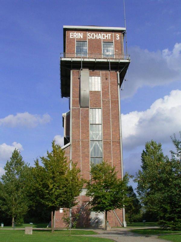
Erinstraße, 44575 Castrop-Rauxel
1989 - 1998
Landschaftsarchitekt Prof. Klaus-Wedig Pridik
Advanced search with more criteria
Total projects: 483
44577 Castrop-Rauxel
Distance: 2.00 km
44575 Castrop-Rauxel
Distance: 2.17 km
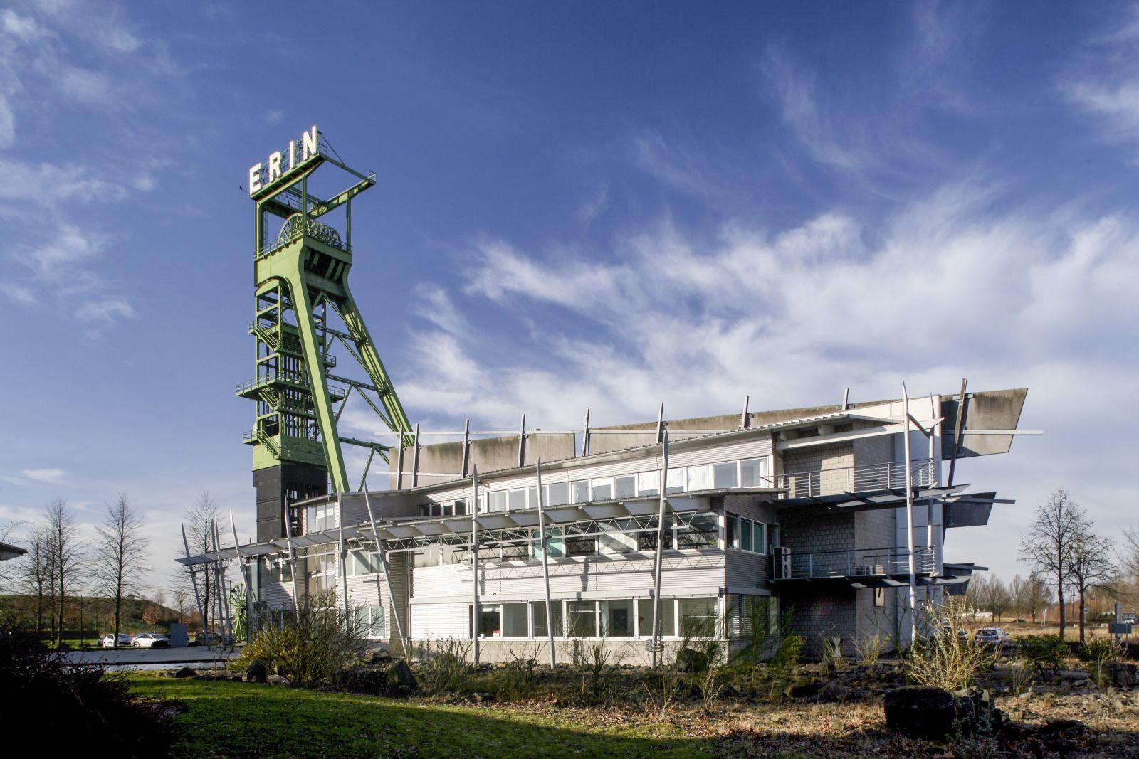
In 1858, Irish-born mining entrepreneur William Thomas Mulvany consolidated a number of mining estates on Castrop territory. In memory of his home, Ireland, he called the 1866 pit Erin, a Latin version of the Gaelic name for Ireland.
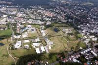
When the pit was closed down in 1983, there suddenly was an industrial wasteland of 42 hectares right on the door of the Castrop city centre.
At the end of the 1980s, the first parts of the area were included in the city’s development plan. When the project was incorporated in the structural programme IBA Emscher Park, the planning approaches combined to form a general project envisaging a service area, a start-up centre, commercial use, undeveloped areas and landscaping.
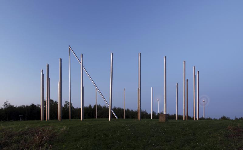
Based upon an urbanistic plan drawn up by the Landesentwicklungsgesellschaft (Land-owned development company; LEG) and supplementary plans by the firms of Professor Pridik and Schlegel und Spiekermann a landscape garden and industrial estate developed whose design draws upon Irish landscapes. Toxic remains were encapsulated in landscape structures which today break down the area into commercial parts like ridges. More than 50 per cent of the area are now parkland.
From Castrop city centre, the main axis is a watercourse, the now uncovered stream ‘Obercastroper Bach’ previously piped.
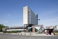
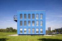
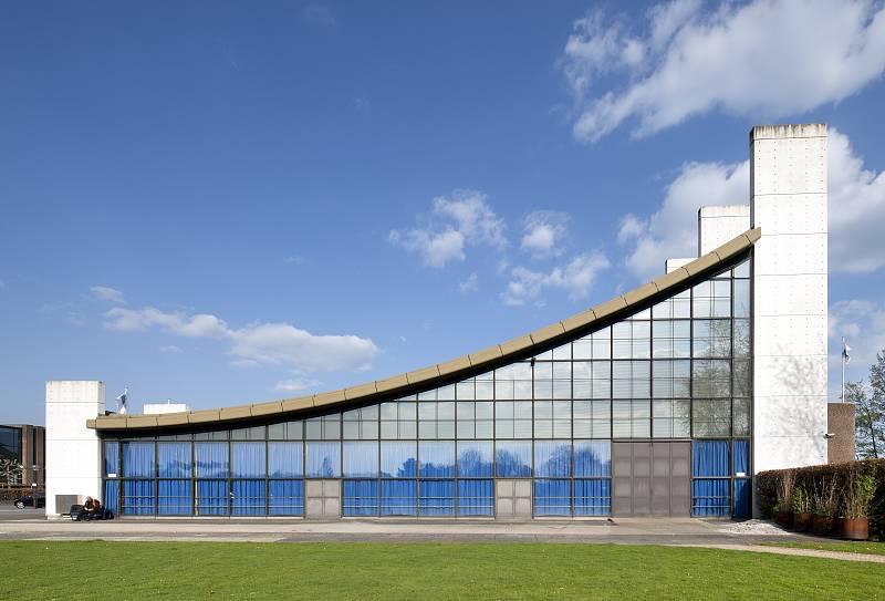
In the east, the park’s edge is formed by modern admin and service buildings.
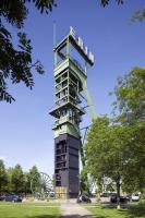
A listed pit head frame reminds us of the city’s mining past. The former industrial buildings, renovated in 1990, have been converted.
Author: Peter Köddermann (MAI) / editorial baukunst-nrw
Text last changed on 31.07.2007
Categories:
Urban Design » Regional Planning
Landscape Architecture » Parks