Bodelschwingher Straße 73, 44577 Castrop-Rauxel
1994
Klaus Corzilius
(pergola)
Jan Bormann
(sundial and cross)
Manfred Walz und Georg Kiefer
(overall concept and day-and-night-panorama)
Peter Strege
(water temple)
Advanced search with more criteria
Total projects: 483
44577 Castrop-Rauxel
Distance: 0.77 km
44575 Castrop-Rauxel
Distance: 2.57 km
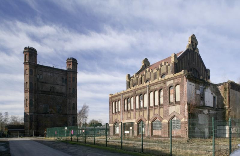
The Zeche Graf Schwerin pit was decisive for the development of the City of Castrop-Rauxel, together with the Erin and Viktor pits. Founded in 1882, in 1887 a coke oven plant was added. As a result of the crisis in the mining industry, in the early 1960s it was merged with the Zeche Lothringen pit in Bochum and closed completely in 1967. The coke oven plant was shut down in 1975. The only still visible sign of Zeche Schwerin is the adjacent Schwerin mining tip.
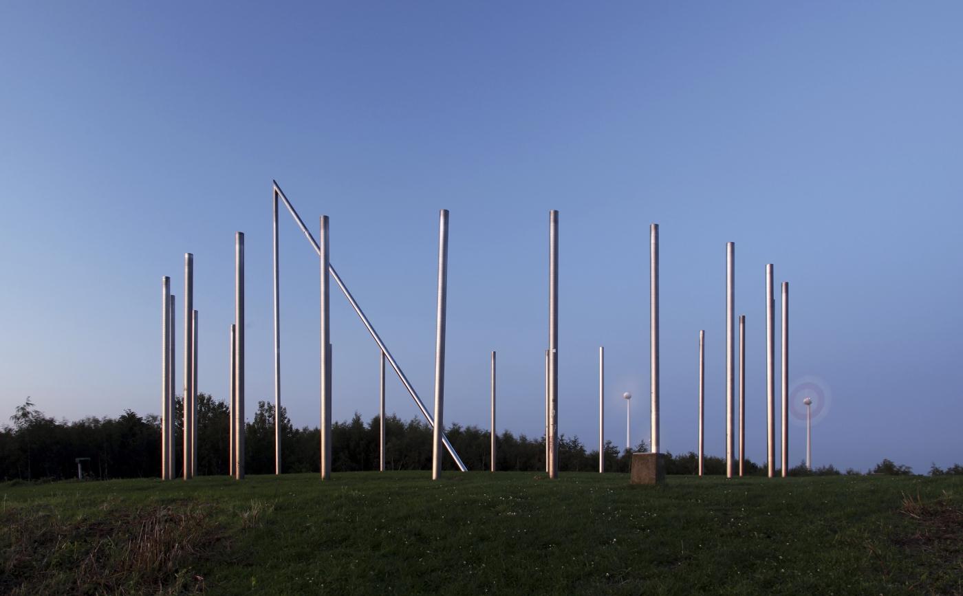
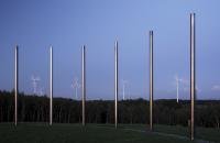
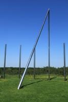
The former tip of Zeche Erin today is the highest point of Castrop-Rauxel and one of the sources of the Deinighauser Bach stream. In 1993, in the course of the IBA Emscher Park construction trade fair a workshop of citizens, artists and planners re-designed it into a landmark with a walkable sundial. The tip is in the regional green belt F and, together with the Halde Brockenscheidt pit in Waltrop, also designed by Jan Bormann, and the former landfill in Dortmund-Deusen (Deusenberg), forms the so-called “Haldendreieck“ (tip triangle).
The dial plate is made of 24 5m stainless-steel steles. The shadow-throwing staff pointing north is at the centre and with the 12-h pipe forms a triangle of 10m in height.
The free space is broken down by four access roads that intersect at the so-called “Geokreuz“ (geo-cross). The two road axes, industrial axis and natural axis, intersect. The industrial axis consists of crude steel and the natural axis describes the way from tree to wood.
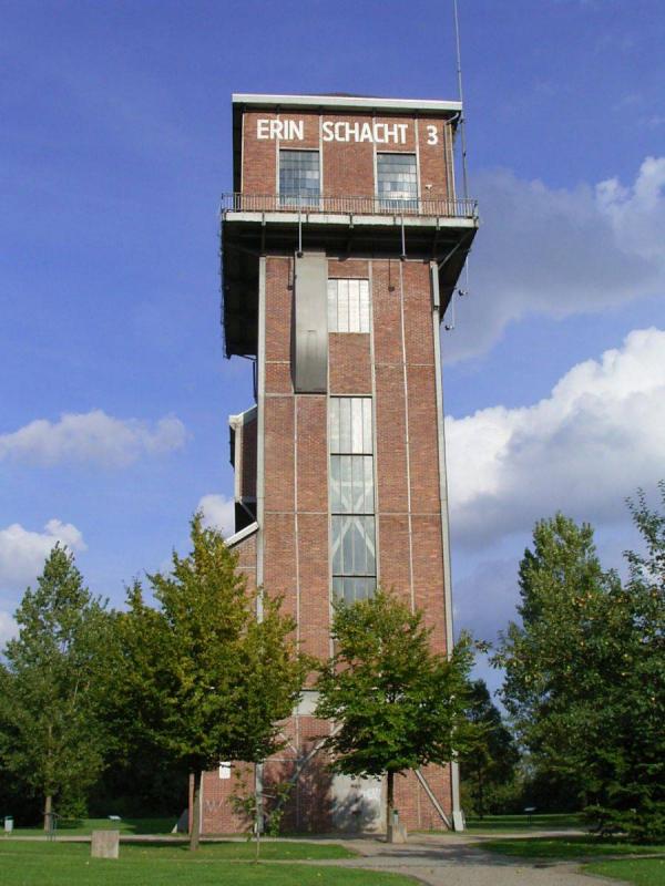
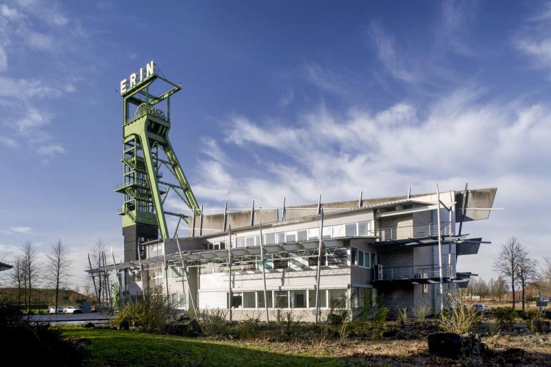
See also Hammerkopfturm Zeche Erin 3
Author: Route Industriekultur / Editorial baukunst-nrw
Last changed on 11.04.2024
Categories:
Landscape Architecture » Parks